IHistory
The Coppermine flows north for eight hundred and forty-five kilometres — from Lac de Gras in the tundra of the Northwest Territories, through a chain of lakes and rapids, to Coronation Gulf in the Arctic Ocean. There are hardly any trees along it: this is the country where the forest ends and bare tundra begins.
Copper gave the river its name. The Dene and the Inuit found native copper on its banks and made knives and points from it. Rumours of copper mountains reached the Hudson’s Bay Company, and in 1770 it sent Samuel Hearne to look for them. He set out with Chipewyan guides in December 1770, walked for more than half a year, reached the river in July 1771 — and found a single lump of copper weighing a few pounds.
Fifteen kilometres from the mouth the river narrows into a gorge and falls over rapids. People have fished here since time out of mind: the char run upriver, meet the rapids, and are taken with spears. Archaeologists find traces of camps by the rapids thousands of years old.
On 17 July 1771 a camp of Inuit catching char stood by the rapids. By Hearne’s account, his Chipewyan companions attacked the sleeping camp at night and killed everyone. Hearne named the place Bloody Falls. His book appeared only in 1795, after his death, and historians still argue whether all of it is true and whether he saw the killing with his own eyes. Today this is Kugluk Territorial Park.
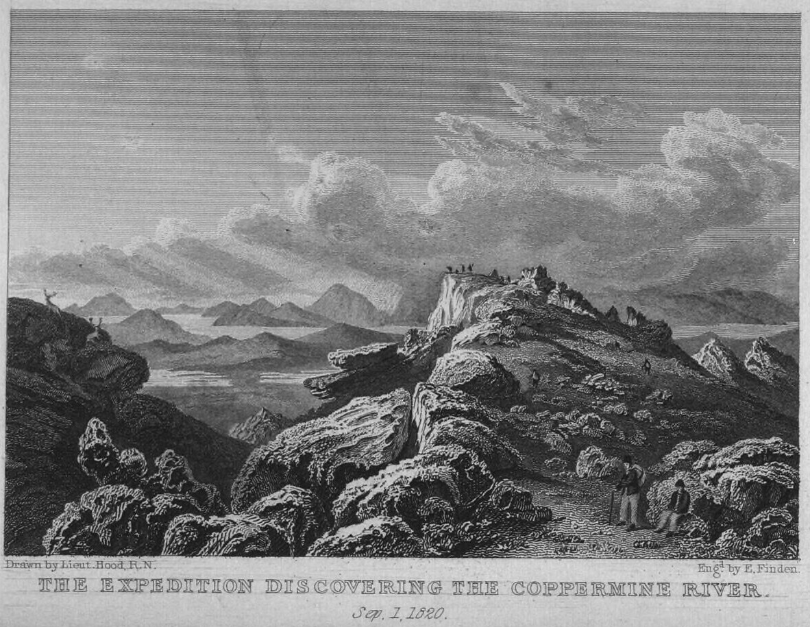
Half a century later John Franklin’s expedition came here. Above the entry is an engraving after a drawing by Lieutenant Robert Hood: on 1 September 1820 the party first sees the Coppermine from the hills. In July 1821 the expedition went down the river to its mouth and reached the ocean. On the way back, in the tundra, the men ran out of food; of twenty, eleven died, and Hood was among them.
IIWhat is there now
At the mouth of the Coppermine stands the hamlet of Kugluktuk — “the place of moving water”. Until 1996 it went by its English name, Coppermine, and then took back its Inuit one. The people here are Inuinnait, Copper Inuit — the very people whose ancestors fished for char at the rapids.
For them char is still first of all food. It is netted at the mouth and in the gulf in summer, speared and hooked at the rapids, jigged under the ice in spring. It is dried, smoked, frozen, eaten raw. A fish that comes from the sea into the river every year is a larder that needs no lock.
Every summer the char, fattened in the sea, go up the river — to winter in fresh water and, if its year has come, to spawn. The lower Coppermine is their wintering hole. Scientists tag the fish and follow where they lie under the ice — to know how many can be taken.
At the river’s headwaters, by Lac de Gras, diamonds have been mined since the late 1990s. So in Kugluktuk the water is watched closely: for the hamlet the river is fish, and fish is life.
IIIWhat is taken here
Arctic char — iqaluk, the river’s great fish; sea-run.
Lake trout — a big predator of the deep lakes upstream.
Grayling — with its tall sail of a fin, a fish of fast water.
Whitefish — several kinds, fish for the nets and the winter table.
And on Coronation Gulf, at the neighbouring Tree River, a hundred and thirty kilometres to the east, the world-record char was taken in 1981.
IVHow it is taken
Recreational fishing
The Coppermine is a river for canoeing and fishing, and nearly everything on it starts in Kugluktuk. In order:
Licence. Anyone who is not a beneficiary of the Nunavut Agreement needs a Nunavut sport fishing licence. Carry it with you.
Limit. The char rules here are strict: by the Nunavut guide, on the Coppermine above Bloody Falls — one char a day and one in possession. Limits are revised, so get the current guide before the trip.
How it is fished. With a spoon — silver or red — across the current; with a fly; at the end of summer, when the char come in from the sea. In spring — under the ice, through a hole, on a jig.
Kugluk park. At Bloody Falls there is a territorial park: a place of memory and a place of fishing at once. Both are respected here.
And the tundra. The weather changes within the hour, and there are bears — grizzlies, and near the coast polar bears too. Go out on the river with a local guide.
The trade
There is no big fishery on the Coppermine: char here is food for the hamlet, not merchandise. The commercial char fishery of these parts is further east, at Cambridge Bay on Victoria Island — since 1960, under quota.
Cambridge Bay’s Inuit name is Iqaluktuuttiaq, “the good fishing place”.
Canadian Encyclopedia and Britannica — river length, Bloody Falls. · Government of Nunavut — Kugluk (Bloody Falls) Territorial Park and the history of the place; Nunavut Sport Fishing Guide — licence and limits. · Samuel Hearne, A Journey from Prince of Wales’s Fort in Hudson’s Bay to the Northern Ocean, 1795; Dictionary of Canadian Biography — Hearne. · Studies of the dispute over Hearne’s account (including Robin McGrath, “Samuel Hearne and the Inuit Oral Tradition”, 1993). · John Franklin, Narrative of a Journey to the Shores of the Polar Sea, 1823. · Fisheries and Oceans Canada — char overwintering in the lower Coppermine, the Cambridge Bay commercial fishery since 1960. · Travel Nunavut — Kugluktuk.